Destinations United States
Joshua St. James
Black Canyon of the Gunnison National Park in western Colorado is home to some of the most dramatic cliffs in North America. Carved by the Gunnison River over millions of years, the park can attribute its incredibly steep cliffs to the grade of the river. The Gunnison drops an impressive average of 43 feet per mile, nearly seven times more than the Colorado River at the Grand Canyon.
Black Canyon is named after its steep, narrow walls that often block out the sunlight, giving the canyon a black appearance. The canyon walls, made of hardened volcanic rock, rise to 2,722 feet above the Gunnison River. At Warner Point, the highest point in the park, elevations reach an impressive 8,300 feet above sea level.
The park is divided into two primary areas: the South and North Rim. Each side offers a distinct perspective of the canyon. The South Rim is more accessible and provides numerous viewpoints, climbing areas, and trails to the park’s higher cliffs, whereas the North Rim is more secluded and has fewer crowds. Because Colorado has some of the best rock climbing spots in the world, this park is a mecca for rock climbers, with over 140 climbing routes throughout the park’s steep canyon walls. Visitors can also hike along the rim and view the Gunnison River from above or choose one of the hardest hikes, exploring the inner canyon. Wilderness use permits are required to explore the inner canyon but are available at either visitor center
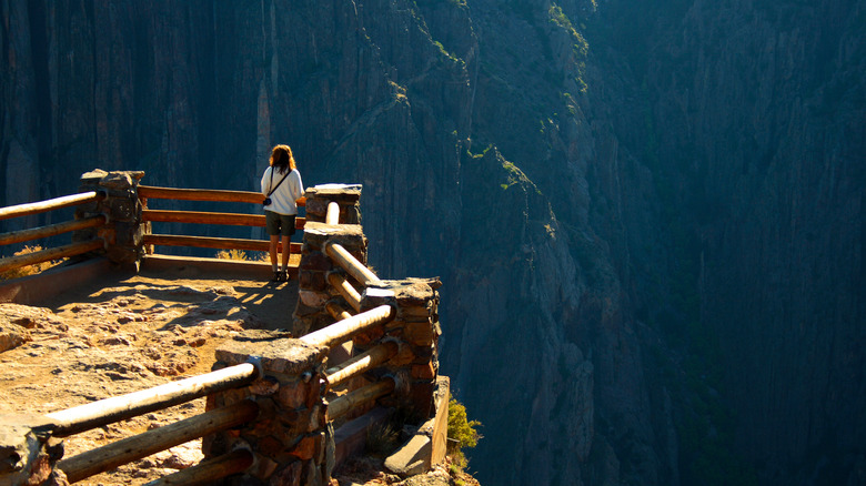
Black Canyon of the Gunnison National Park is home to the highest vertical cliff in Colorado

Andy Magee/Shutterstock
The Painted Wall, the South Rim’s most iconic feature, stands at an impressive height of 2,250 feet. To put it into perspective, the Painted Wall is nearly twice as tall as the Empire State Building (at 1,250 feet). This cliff is a favorite among visitors, with a short 0.2-mile trail to the cliff’s edge, known as the Painted Wall Overlook.
The overlook gives visitors a stunning view of the canyon from the top of the Painted Wall. The Painted Wall Overlook also offers views of the Gunnison River’s deep and narrow channel from one of the highest vertical points in the park. Visitors can see the full height of the wall and a straight-on view of its marbling at the adjacent trail, Dragon Point. Tucked between the Painted Rock Overlook and Dragon Point, the Cedar Point Nature Trail also takes you to an overlook to view the face of the wall.
Experiencing the Painted Wall from the North Rim section of the Black Canyon gives views of the true length and depth of the canyon. The Chasm View Nature Trail is a popular hiking trail along the North Rim that takes visitors to the edge of the North Rim at one of the highest vantage points. Chasm View is 1,800 feet above the Gunnison River along the North Rim, offering views of the Painted Wall and Serpent Point, another cliff in the park.
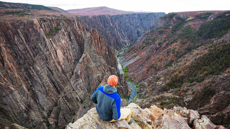
Black Canyon’s steep cliffs are enhanced by how narrow they are

Galyna Andrushko/Shutterstock
As if being one of the steepest canyons in North America wasn’t enough, the Black Canyon of the Gunnison is surprisingly narrow. At many points, the canyon is deeper than it is wide, with the narrowest section appropriately named “The Narrows,” where the Gunnison River flows through a 40-foot wide channel. The canyon’s uniquely narrow shape has also led to the formation of several geological features that are rare to find in other canyons.
One unique formation attributed to the canyon’s unique geology is the “Gunnison Uplift.” The Gunnison Uplift is a section of the canyon where ancient rock layers have been pushed upwards, creating a steep and jagged ridge. The canyon’s depth and width result from the Gunnison River’s powerful erosive force, cutting through the nearly two billion-year-old Precambrian rock of the Gunnison Uplift.
The best area to experience the Narrows is from the Narrows View Trailhead, off of G74 Rd in the North Rim section of the park. This short loop trail leads to an overlook that offers views of the sheer cliffs and the narrow section of the canyon. The vantage point of this overlook allows you to look down the canyon, following the path of the Gunnison River as it flows through the narrow channel.

